
Counter Creeks Project
Counter Creeks Project


Barhale awarded CTS 80% of the overall Counter Creeks project, The Purpose of the surveys will assist in the planning phase for new infrastructure, at Low level and the design of a Deep Tunnel.
CTS Carried out surveys in stages to assist in the Positioning of 49 Boreholes for Monitoring purposes and later large areas of PAS128 Type a Surveys to assist with planning, the company also carried out Laser Scanning of streetscapes, Bridges and Underground structures which were mainly Large Diameter Storm and Sewer tunnels.
The first Stage of the contract was for CTS to carry out C2/Plant Enquiry’s for the entire project, from this information Stat packs were created in PDF format and A3 Bound copies for the clients who used them for their site excavation teams to meet HSG47. CTS Used their IPad Airs to view all the information for the Project.
The Stage 1 Site Surveys for the Borehole locations were managed in-house and carried out by Two-man survey teams, One Utility Surveyor detecting underground pipes and the second surveyor collecting data which had been marked on the ground, upon completion the data was emailed directly from site to the office for the Cad drawing to be created in 2D top view with X,Y,Z coordinates to Ordnance survey National Grid, CTS used its Internally designed Feature and Attribute library which creates a Layering system to Statuary undertakers and incudes depths, sizes, configurations, widths, heights, types, Top of pipe depths, Invert levels and more. Upon completion these were sent via email or CTS WE Transfer account to the client to verify and then implement the final position of the bore hole, all 49 drills were successful from 10 to 30 meters in places. This demanding process was managed successfully and there were no hold ups to the drilling teams.
Stage 2 Site surveys were carried out on large areas from 500 meters to 4 kilometres from boundary to boundary and lot more detailed in the data to allow for 3D cad design of all underground utilities and Surface Features, including Signs, Street Lamps columns, Chambers, Tress and more. Again the CTS Feature coding allowed for the smooth transition from site data to office 3D Accurate Cad Design.
CTS implemented its own in house Traffic management vehicle to allow for surveys to be carried out in the carriage way on low speed urban roads, CTS Surveyors are trained in NRSWA for signing lighting and guarding.
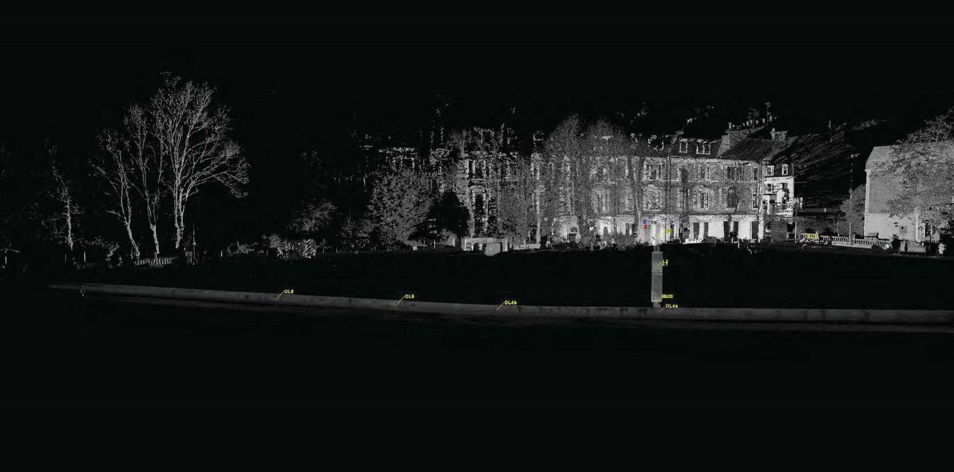
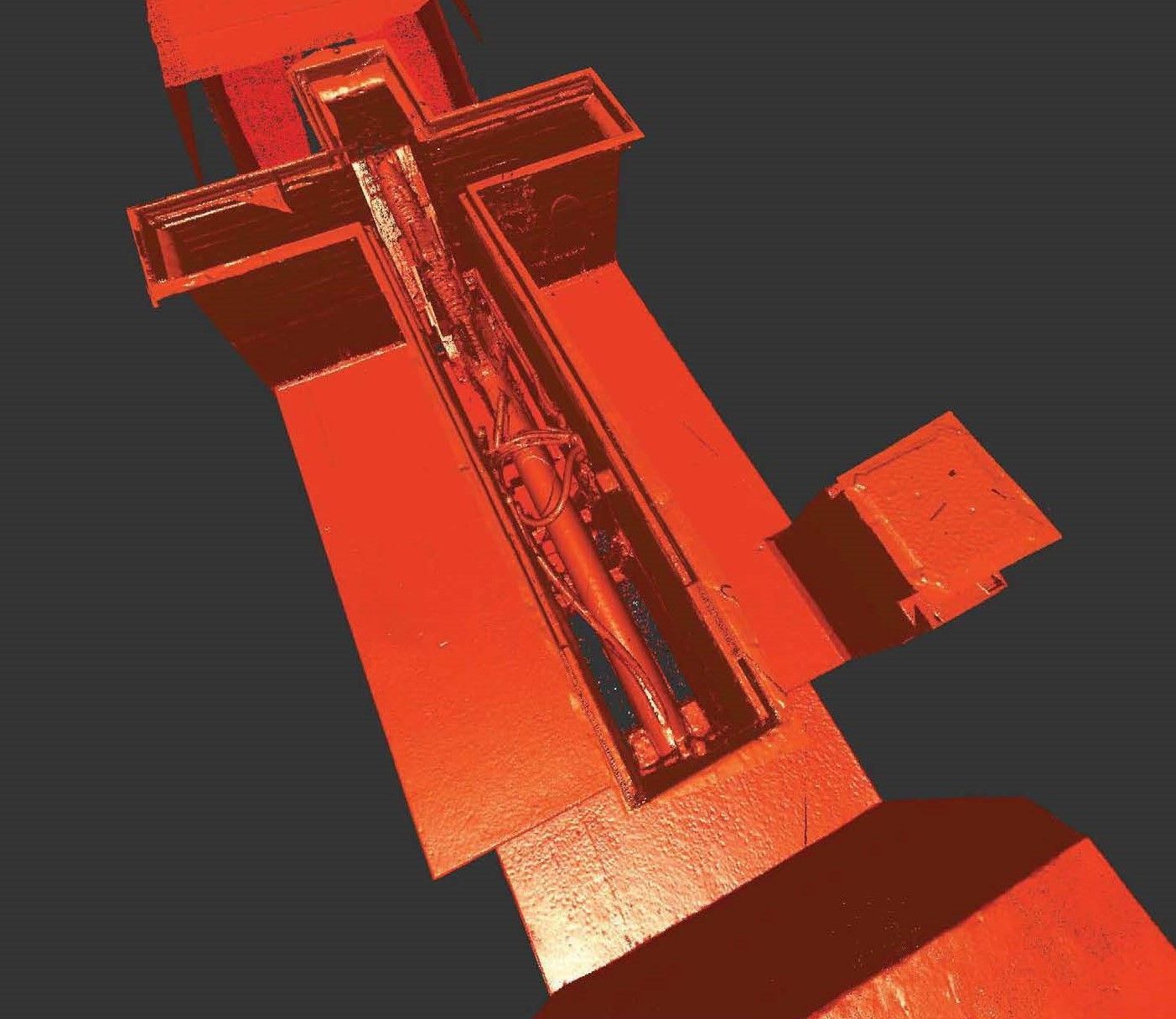
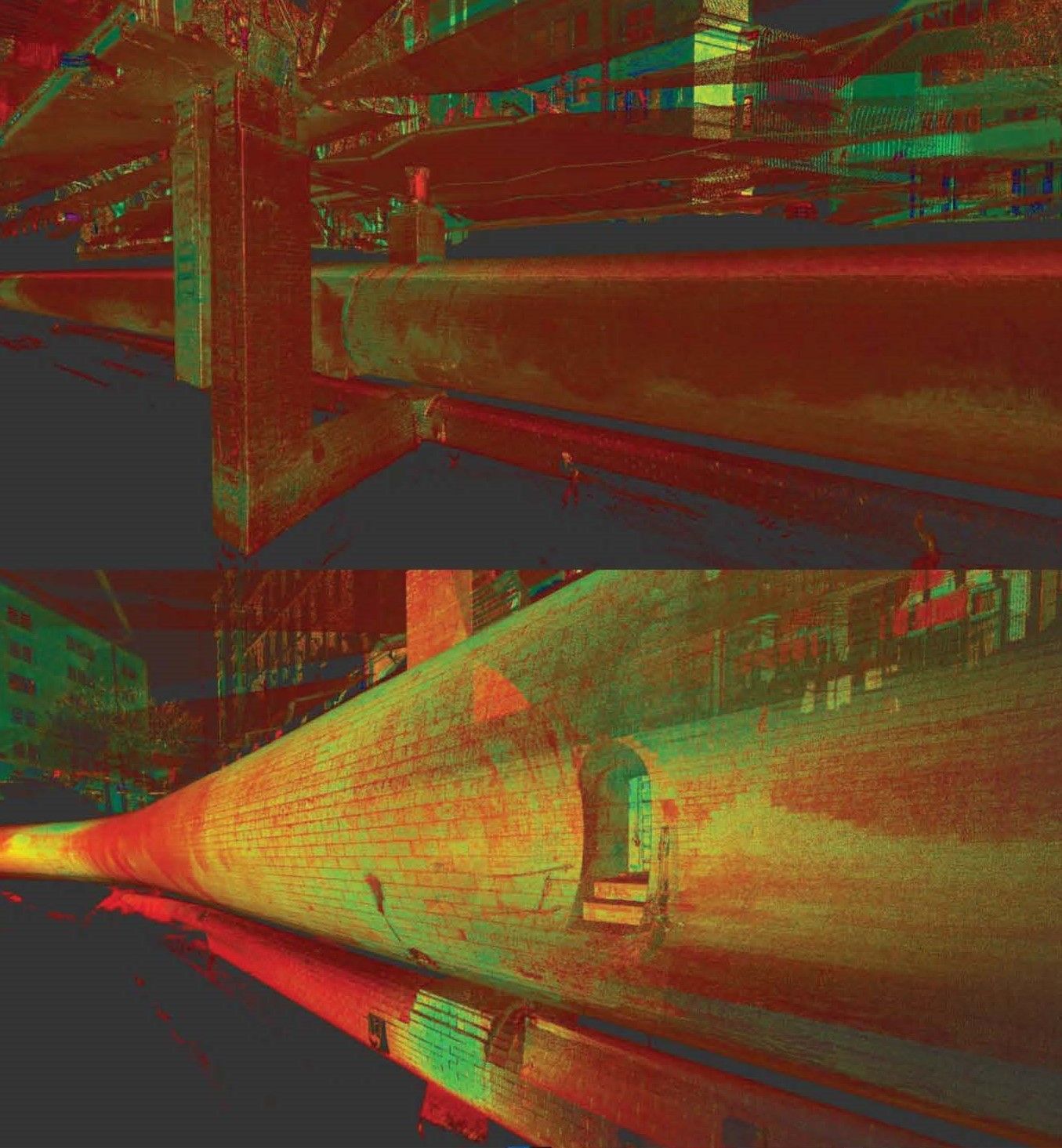
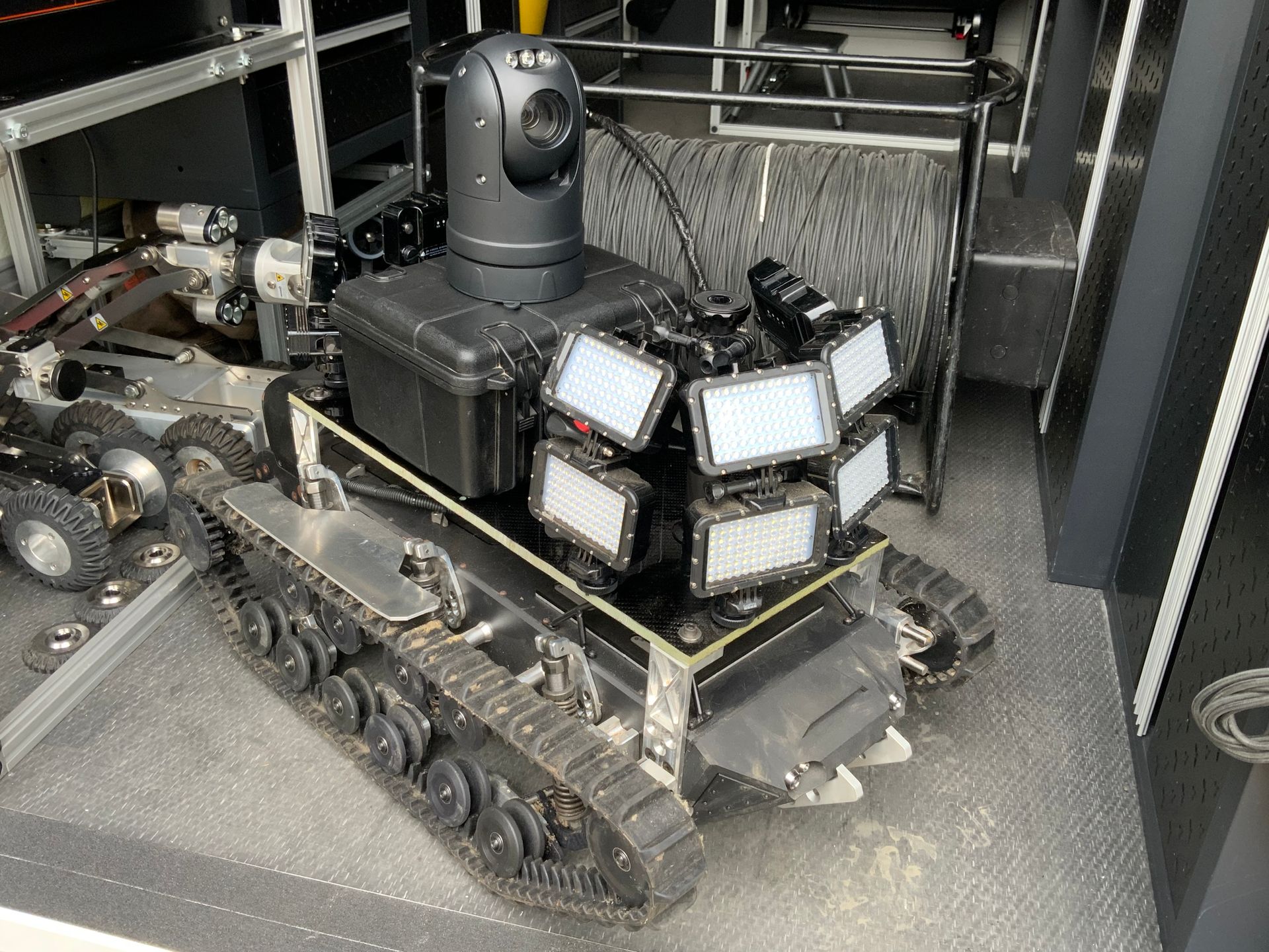
Stage 3 Site Surveys were carried out on the large areas were a two-man Survey team used its owned Leica P40 Laser Scanner to scan the streetscapes, two rounds of scanning were carried out which included HD photography, the point cloud data was register using Cyclone software and the point cloud was created in True-colour, the files were provide to the client in. RCP, RCS Format and Truveiw format. The data was sent to the client on usb3.0 - 2TB Hard drives.
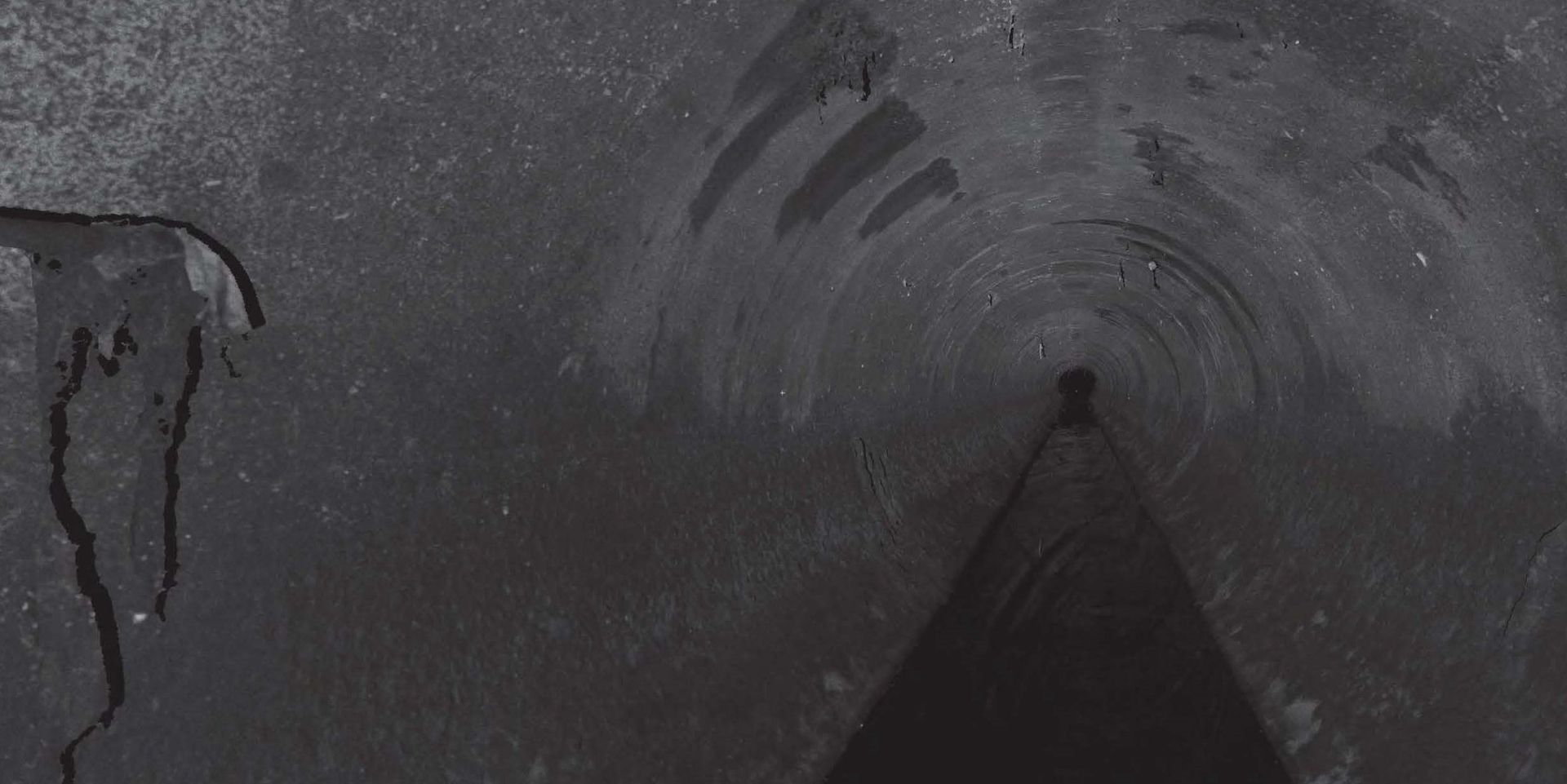
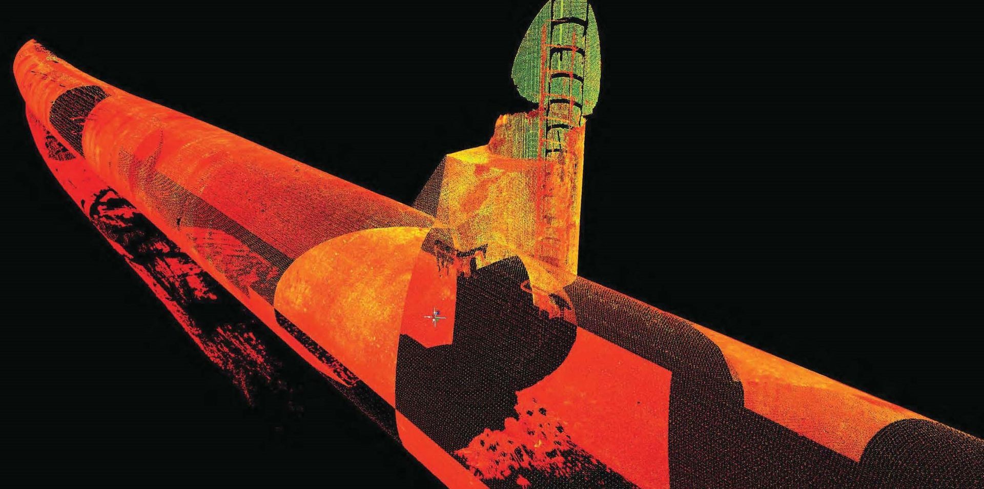
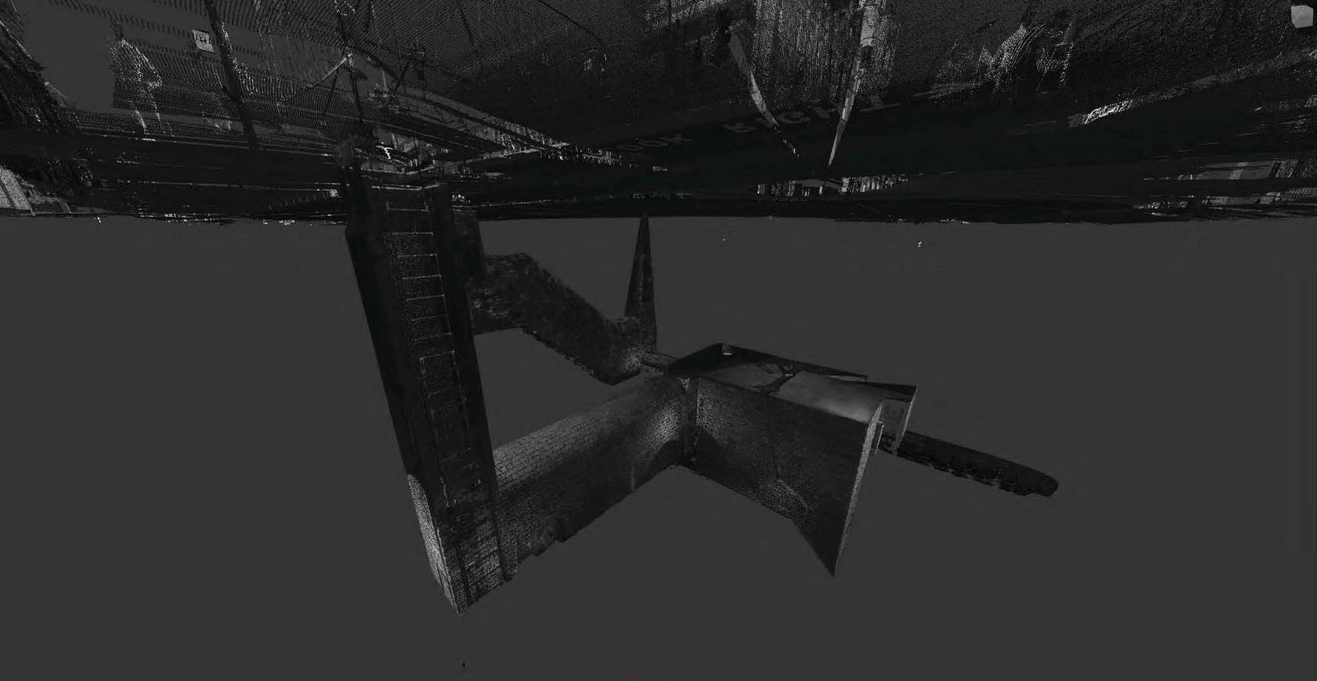
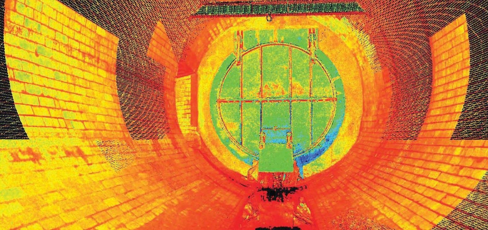
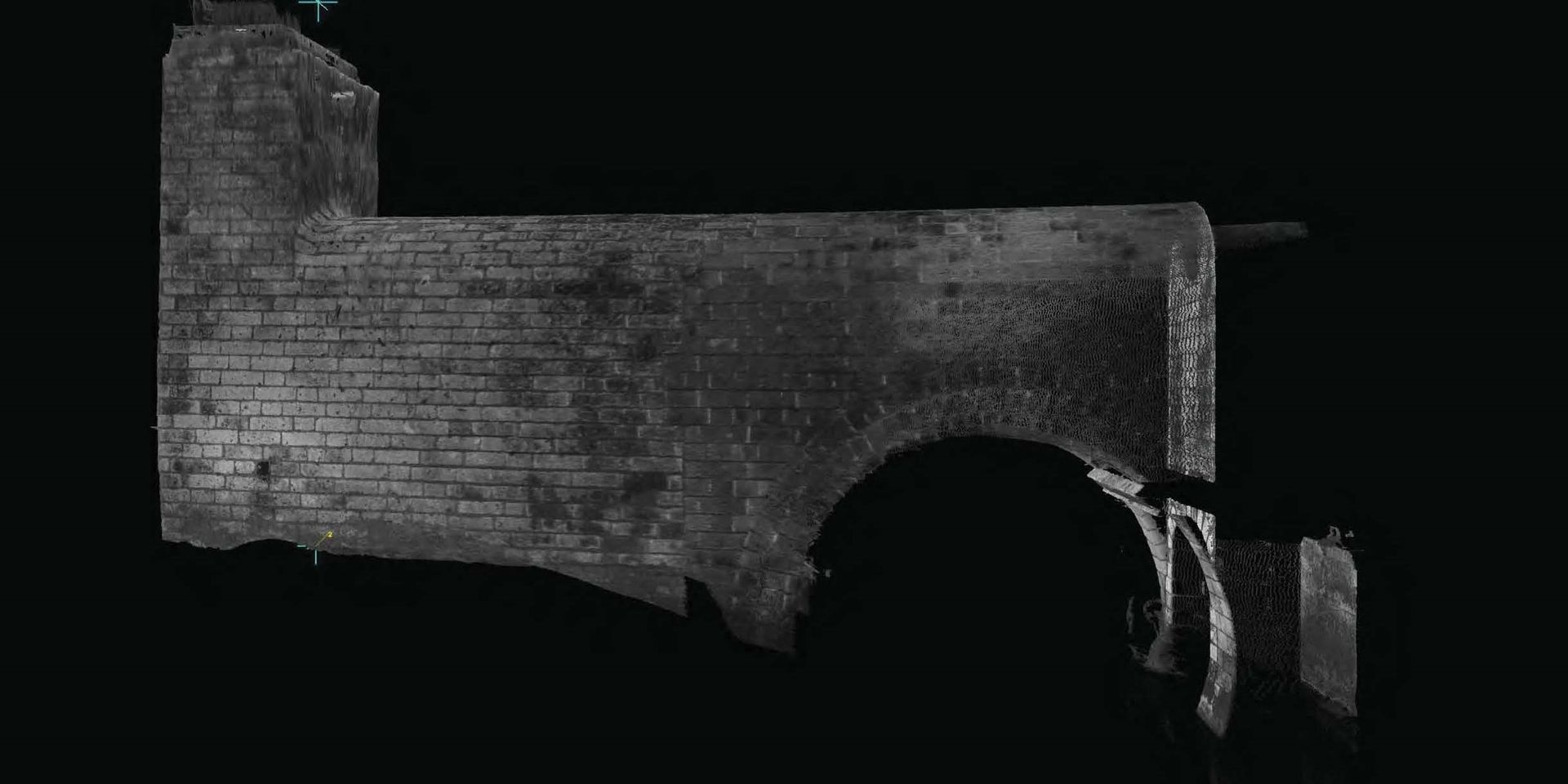
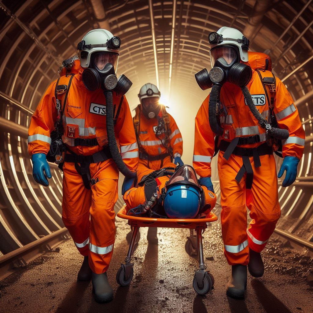
Stage 4 Site surveys were carried out in confined spaces, the same surveyors used the scanner to traverse underground to collect point cloud data in some very dark conditions, these were mainly large sewer and storm tunnels, a single round of HDS scanning using the P40 was carried out. The scans were later combined and registered with the streetscape scans to create accurate Line and level of the tunnels, the point cloud data was also used for condition surveys, the files were provided to the client in. RCP, RCS Format and Truveiw format all in Grey scale.
Stage 5 site surveys involved the surveyors entering into resident’s properties to carry out laser scanning of basements to allow for accurate line, Level and condition.
CTS Surveyors used their Thames water passport training to good effect with all property owner’s concerns being answered in a professional manner, the key focus on these entries were relationships first and care of duty to the residents and their property.
The large amount of detailed data was managed with a simplistic approach using the CTS internal cloud system, the survey data was set up in project folders by area and stored in the cloud which has a real-time back up system.
© Copyright CTS Ltd. 2023